Measure whether the error is global or local
Place temporary markers at several known boundary points and observe supervised passes from a safe distance. A similar offset around the property suggests a reference or map-coordinate issue. Drift limited to one corner points more toward signal obstruction, a visual landmark problem, slope, or wheel slip. Note weather, time, and satellite status when the error occurs.
Audit everything that can move
Verify the dock anchoring, RTK pole position, antenna level, cable connections, and mounting hardware against installation records. Even a small antenna rotation or a dock pushed by equipment can change a learned relationship. Do not relocate components to improve one weak area until the current coordinates and map have been backed up or documented.
Look for environmental changes
Leaf growth, a new shed, parked trailer, metal fence, trampoline, stacked materials, or irrigation spray may alter reception or vision. Low sun, heavy rain, and dirty cameras can produce condition-specific behavior. Keep lenses and permitted sensors clean, maintain required sky view, and test after removing a temporary obstruction instead of changing many settings at once.
Exclude odometry and traction errors
Mapped machines may combine satellite or visual position with wheel movement. Mud, uneven tire wear, a dragging caster, or repeated slip on a bank can distort that estimate. Clean the running gear and test a straight pass on dry level ground. Curved travel, wheel errors, or unequal speed away from the problem area deserves mechanical diagnosis.
Calibrate or remap in the correct order
Install stable firmware only when the maker recommends it, complete documented positioning or compass calibration, and restart components in the specified sequence. If a fresh map is necessary, create it under good reception with careful edge spacing and no temporary obstacles. Continued boundary violation is a safety issue; keep the mower stopped and send logs to support.
For a product-led next step, compare Robotic Lawn Mowers for Hills or use the yard-fit finder.
Products to evaluate against this advice
As an Amazon Associate, we may earn from qualifying purchases.
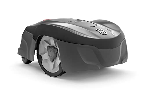
Husqvarna Automower 115H 4G Robotic Lawn Mower for 0.4 Acre
The Automower 115H 4G is a useful benchmark for owners who value an established boundary-wire system over antenna placement or camera mapping. Its high-cut orientation can suit common residential turf, but the cable installation and current listing availability should be weighed before purchase.

ANTHBOT Genie 600 Wire-Free Robotic Lawn Mower for 0.15 Acre
The Genie 600 is the small-lawn choice in the verified Genie lineup. This canonical page uses one ASIN and deliberately avoids duplicating a second Amazon offer carrying the same model name; the key buying issue is the exact kit attached to the live offer.

LawnMaster OcuMow VBRM601YCM MAX Wire-Free Robot Lawn Mower
The OcuMow MAX extends LawnMaster’s optical concept into a higher square-foot band. It is a stronger candidate than the smaller portable model when the lawn is still simple but takes too long for repeated short sessions; complex islands and indistinct edges remain the important caveats.
Frequently asked questions
Does map drift mean the GPS hardware is defective?
Not necessarily. Reference movement, blocked sky view, wheel slip, landscape changes, or software state can produce similar symptoms.
Will making the virtual boundary wider fix drift?
It may hide a small error while sacrificing coverage, but it does not correct an unstable position source and can fail elsewhere.
Should I delete the old map before contacting support?
Usually not. Screenshots, logs, and the existing geometry may help diagnosis. Preserve them until the manufacturer advises otherwise.
Bottom line
Use the answer above as a decision framework, then verify the exact product manual, current listing and conditions in your own lawn. Model generations, software features and included accessories can change.