Start by decoding the GPS claim
The same label can describe very different functions. One mower may use satellite location only to show its whereabouts after it leaves a geofence. Another may use corrected satellite positioning to steer planned mowing lanes. Look for an explanation of virtual-boundary accuracy, correction source, antenna needs, subscription terms, and behavior when the high-precision fix is unavailable.
LiDAR creates a local frame of reference
By repeatedly measuring distances, LiDAR can help the mower locate itself relative to fences, trunks, walls, and other features. This environmental map supports route planning without asking a satellite system to define every edge. Yet local maps require stable recognizable geometry, and sensor contamination, major scene changes, unusual surfaces, or insufficient features can reduce confidence.
Open lawns favor satellite-based positioning
A large yard with a clear view of the sky may provide excellent conditions for corrected positioning. The mower can use coordinates to divide acreage into work zones and produce orderly passes without needing prominent objects everywhere. Evaluate coverage near the house, under mature trees, along retaining walls, and beside neighboring buildings rather than judging only the unobstructed center of the lawn.
Enclosed spaces can favor local sensing
In a courtyard-like lawn or a property framed by trees and structures, LiDAR may have useful surfaces to observe while satellite reception is inconsistent. The reverse problem can appear in a broad, nearly featureless field. Vision, wheel odometry, and inertial sensors often fill these gaps, which is why the complete sensor fusion matters more than a one-word comparison.
Security and navigation are separate decisions
A LiDAR mower may still include cellular or satellite-based location tracking, while a corrected-GPS mower may use cameras for obstacles. Do not trade away theft alerts simply because local navigation looks strong. Compare account locking, geofence notifications, connectivity, recovery options, and the manufacturer’s support process alongside the mowing technology.
For a product-led next step, compare Wire-Free Robotic Lawn Mowers or use the yard-fit finder.
Products to evaluate against this advice
As an Amazon Associate, we may earn from qualifying purchases.

ANTHBOT M5 LiDAR Robotic Lawn Mower
This M5 is the LiDAR-identified version in ANTHBOT’s catalog. Its page should be compared against the separate non-LiDAR M5 ASIN, because sensing hardware can affect setup, obstacle detection and performance under tree cover even when the model family name looks nearly identical.

ANTHBOT M5 RTK and Vision Robotic Lawn Mower
The non-LiDAR M5 ASIN belongs on its own page only because Amazon identifies a different navigation configuration. It may appeal to yards with good satellite visibility, while the similarly named LiDAR version warrants separate setup and obstacle-detection questions.
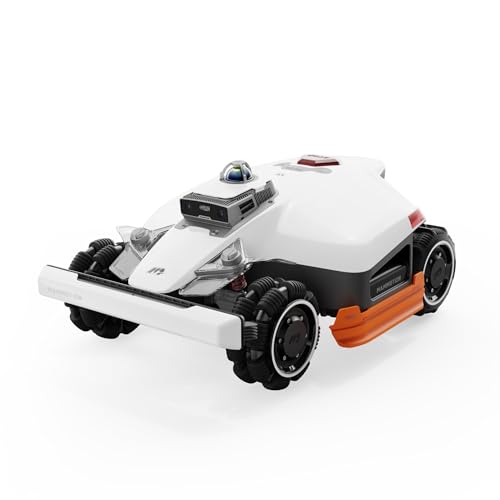
Mammotion LUBA 3 AWD 3000H Robot Lawn Mower for 0.75 Acre
The LUBA 3 AWD 3000H is specifically the high-cut 3000H identity, not a generic LUBA 3. Its 80% slope claim and multi-sensor navigation target demanding properties, but weight, wet-ground behavior and access between zones deserve close scrutiny.
Frequently asked questions
Can normal GPS keep a robot mower inside a virtual boundary?
Basic satellite location alone is usually too variable for a precise lawn edge. Products that advertise accurate virtual boundaries normally add correction data and other onboard sensing.
Does LiDAR need daylight?
LiDAR produces its own ranging signal and does not depend on visible daylight in the way a camera does. A mower may still use cameras or safety rules that affect nighttime operation.
Which is better for a flat open acre?
Corrected satellite navigation can be a natural fit for open sky and a large mapped area. Confirm capacity, charging strategy, cut width, and support rather than choosing on navigation alone.
Bottom line
Use the answer above as a decision framework, then verify the exact product manual, current listing and conditions in your own lawn. Model generations, software features and included accessories can change.