Ask what GPS does in that mower
GPS can support location reporting without controlling every mowing path. In another model it may contribute directly to systematic coverage. Read the navigation and installation sections of the manual and separate anti-theft location, route planning and boundary precision instead of assuming one GPS badge includes all three.
Understand the correction source
RTK positioning relies on correction information from a local base, network or other supported source. Determine what hardware, connectivity and placement the system requires. If a service provides corrections, learn whether access is included and how the mower behaves when the connection is unavailable.
Survey sky obstructions
Canopy, walls and buildings can block or reflect satellite signals. Conditions can differ sharply between the dock and the far side of the lawn. Walk the whole boundary, note narrow corridors and compare them with documented siting requirements before committing to a satellite-led design.
Review fallback behavior
A robust mower may combine inertial sensors, wheel measurements, cameras or other inputs with satellite positioning. Those aids do not guarantee identical behavior during signal loss. Check whether the machine pauses, proceeds cautiously, returns, or requires manual recovery in the conditions described by its maker.
Compare map control and records
Precision is useful only when the owner can create, edit and restore boundaries confidently. Examine zone limits, exclusion areas, map backup, account transfer and software support. An excellent positioning specification paired with a confusing mapping process may still be a poor ownership fit.
For a product-led next step, compare Robotic Lawn Mowers for Hills or use the yard-fit finder.
Products to evaluate against this advice
As an Amazon Associate, we may earn from qualifying purchases.
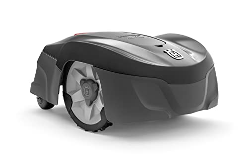
Husqvarna Automower 115H 4G Robotic Lawn Mower for 0.4 Acre
The Automower 115H 4G is a useful benchmark for owners who value an established boundary-wire system over antenna placement or camera mapping. Its high-cut orientation can suit common residential turf, but the cable installation and current listing availability should be weighed before purchase.

ECOVACS GOAT O1000 RTK Wire-Free Robot Lawn Mower for 1/4 Acre
The GOAT O1000 RTK targets buyers who want virtual boundaries without moving to a large-property machine. Its combination of satellite positioning and visual sensing is most relevant where the yard has a usable sky view and clear passages rather than dense tree cover at every edge.
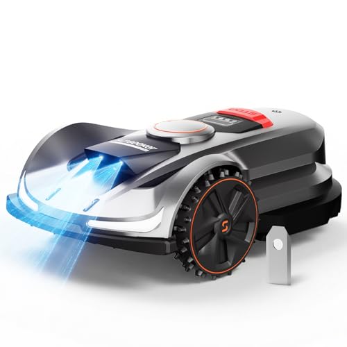
Sunseeker X7 AWD Wire-Free Robot Lawn Mower for 0.75 Acre
The X7 AWD combines a larger residential coverage class with four-wheel traction. It deserves attention on rolling properties where a two-wheel robot may lose grip, although buyers still need to judge satellite visibility, narrow corridors and the actual steepest mowing line in the yard.
Frequently asked questions
Is RTK the same as GPS?
RTK uses satellite positioning plus correction information to improve accuracy. The implementation and correction source vary by system.
Does every GPS mower use virtual boundaries?
No. Some use GPS mainly for tracking or coverage assistance while still relying on boundary wire.
Will RTK work under dense trees?
Performance can be reduced by blocked or reflected signals. Evaluate the exact system's requirements and its supported fallback behavior.
Bottom line
Use the answer above as a decision framework, then verify the exact product manual, current listing and conditions in your own lawn. Model generations, software features and included accessories can change.